Archive for May, 2015
Recency Bias in Mapping, an Exploration
Posted by G.P. in Cartography Profession, Design on May 27, 2015
I’ve been thinking about recency bias lately. In finance, recency bias is the problem whereby people think that securities trends from the recent past will continue into the future. Instead of focusing on market fundamentals or buy-and-hold strategies, people tend to jump on bandwagons instead, which works until the cycle changes.
Recency bias also applies to many other aspects of human behavior, so how might it apply to map design? One way it applies is that, until the cartography landscape was disrupted around the late 2000s, people tended to make all their GIS maps very similarly. I say “GIS maps” because there were some people making well-designed maps with Illustrator and other design tools before that but the GIS people, for the most part, hadn’t caught on to those skills or those techniques.
Along came some new tools like TileMill (now MapBox), an influx of design-oriented mappers to the field, and new and interesting datasets to map, and suddenly the bar of map design was raised. I predicted this in the 1st edition of GIS Cartography in 2009. Those who were assuming that GIS map design would remain the same were creating increasingly obsolete visualizations.
Let’s show this by example.
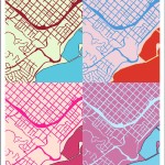
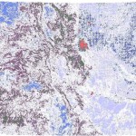
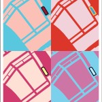
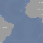
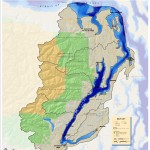
Prior to the late-2000s disruption, we frequently encountered maps that appeared to be slapped together, often with a multitude of diagonal hashes making one feel rather dizzy like in the map shown below. These maps would contain some superfluous details to meet edge-cases (observe the grid-like layer in this map example) and would omit basemap information such that no underlying geographic context could be ascertained. Now, admittedly, these were not always the fault of the map maker. Indeed, the edge-case layers would have been included at the behest of some boss who was the only one who wanted to see that information. Similarly, the basemap information would be omitted due to a lack of availability of that kind of information.

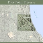
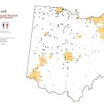
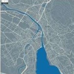
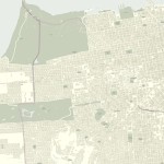
Thankfully we see many fewer of the types of maps shown above and many more of the maps shown below. In this map we have geographic context, gleaned from a nice and subtle baselayer of buildings and streets along with some very nicely done trees. There is some hashing but it comprises a small minority of the overall space. Interestingly, this map manages a significantly better visual experience with much more information. The richness of information makes it both more functional and more beautiful.

What kind of recency bias in mapping do we see today? What kind of recency bias is affecting your map designs? Could an adherence to established practices be holding back your cartographic potential?
Portfolio, Map Gallery
In addition to authoring books, giving talks and workshops, and creating tutorials, I make maps! Here is just a small selection.


Colorado Geo Meetups, Groups, and Lists
Posted by G.P. in Cartography Profession, Education, Uncategorized on May 6, 2015
Are you a Colorado geo-professional who would like to do some networking while learning more about all things spatial? I recently put together this list of resources for those residing in our state–along with a couple of more general twitter groups–and wanted to share it on the blog. Anything I left out? Please tweet me or write a comment.
Meetups:
Maptime Boulder. Evening gatherings to learn together, sometimes OSM focused. Beginners welcome.
GeoDev Meetup Group. Run by Esri. Typically in Fort Collins at the Rio.
NoCo GIS Users Group. Run by Brian Sullivan, presentations and networking. Loveland, Greeley, Fort Collins, the location rotates.
Geospatial Amateurs, Denver. Run by Peter Batty, Brian Timoney, and Nate Irwin. Local pub, evening gatherings, networking time plus a few presentations.
MaptimeMileHigh, This group is just getting started. Evening gatherings to learn together, sometimes OSM focused. Beginners welcome. @maptimemilehigh on twitter for updates.
General code groups/contests:
Women who Code Boulder/Denver.
Lists, etc:
Rocky Rogues. They do “night out” events and also maintain an online job board.
GIS Colorado an active listserve and website.
Twitter groups, non Colorado focused, you can follow along even if you’re not on twitter:
#geowebchat, 1:00 MT on 1st Tuesdays
#gistribe, 1:00 MT on Wednesdays
@PetersonGIS I feel like the Fort deserves a Maptime!
— Sean Gillies (@sgillies) May 6, 2015
@PetersonGIS I'm moving to Colorado next month, so this list is very helpful!
— Kiri Carini (@tomatopurl) May 6, 2015
Speaking at the GeoRodeo
I’ll be speaking at the Texas GeoRodeo on May 22, 2015 in Austin, Texas on the topic of Cartography in the Modern World. Please take a look at the GeoRodeo site for more information.
-
You are currently browsing the archives for May, 2015
The Books


Recent Comments