Archive for category Education
Online Map Games To Encourage and Engage Your Geographic Awareness
*reprinted with permission from GISuser.com.
by Gretchen N. Peterson
This article showcases some of the interactive maps that are scattered around the Web. They aren’t known for their cartographic excellence by any means. However, they are simple games that everyone can play to increase their geographic awareness. Or at least their awareness of political boundary shapes and country and state names. There’s actually a big difference between geographic awareness and knowing these shapes and names, as a matter of fact, but these games at least give people a good nudge in that direction.
Before describing some good interactive map games, it would be prudent to point out that this was probably the most fun article I’ve ever researched (usually games are a means of procrastination not a means of getting work done).
While most articles like this will start with some facts about the woeful state of geographic knowledge existing in the U.S. and then go on to say how shameful it is that we are in such a state of ignorance, this one states some of those statistics and discuss them from a perspective that is not often heard.
Beginning with the statistics, a Roper poll conducted in 2006 of 510 people for National Geographic, and widely cited on the Web, states that: 33% could not locate Louisiana even though this poll was conducted fairly soon after Hurricane Katrina; 60% could not locate Iraq and 75% could not locate Israel on a map of the Middle East; and fewer than 30% feel it is important to know country locations that are in the news.
So here’s where the erudite readers are supposed to be appalled at all these ignoramuses running around claiming that this knowledge is not necessary. This makes me think about Henry Ford, the founder of Ford Motor Company. He was on trial once and was incensed at the prosecuting attorney who was trying to establish his general ignorance. To do so, the attorney asked him questions about U.S. history. After one of these questions Ford famously said, “Now, will you kindly tell me, why I should clutter up my mind with general knowledge, for the purpose of being able to answer questions when I have men around me who can supply any knowledge I require?” For better or for worse, the mindset that one can be highly effective even without certain knowledge by relying on others who do have that knowledge, is where many people are coming from when they say that geographic place names are not important to them.
There’s another argument to be said here, and that is the idea that knowing country names is not the same as knowing anything about those countries. A similarity can be drawn with that thought and physicist Richard Feynman’s evaluation of the Brazilian educational system of 1950. Feynman observed the Brazilian students and noticed that all they were doing was memorizing physics facts. When asked to solve a novel physics problem, the students were, for the most part, unable to use their (considerable) rote-knowledge to answer the problem.
So clearly there is more to geographic awareness than some would like to believe. However, learning place names and locations is a very good first-step toward gaining this knowledge. And to that end, the following online games are a great way to obtain it while having fun in the process. Enjoy!
1. MapDuel:
This one may give you a bit of vertigo with all the zooming around, but it is the only one I’ve found with a question / answer format. It covers the whole globe. I did find one glitch. In a bonus question it asked me, “What is the language of this country?” when it was referring to a U.S. state. Be sure to click on the “Where the h*** is Matt?” link too.
2. MapGame:
Not a competitive game but the fact that it focuses on Middle Eastern and Northern Africa countries makes it pertinent to current events in that region.
3. States:
To win this game you must type in the names of all 50 states in 10 minutes. It places the name of the state that you’ve just typed in its proper location. Don’t forget Alaska and Hawaii (or New Jersey).
4. 50states:
With this game you have to drag and drop a state shape to where it belongs on a U.S. map. It allows you to get it mostly right via snapping within a certain tolerance. You can compete with others for the best score.
About The Author…
Gretchen N. Peterson writes on the subjects of GIS analysis, cartography and ethics. Ms. Peterson is the owner of the geospatial analysis firm PetersonGIS. You can follow her on Twitter @PetersonGIS
Thanks to Tina Cary (@tinacary on twitter) for this topic idea.
Introducing Maps to Kindergartners
Kindergartners don’t know a lot about maps. Indeed, most mapping related concepts are much too difficult for them to comprehend. I don’t find that maps are too abstract for them, instead, I find that the kids apply such a force of imagination to maps that their interpretations are much too distorted.
That said, it is still important for them to know the general ideas behind a map: what forms it can take, whether on your car’s GPS unit or your computer or on a folded-up piece of paper and what it does (in most simplistic terms such as “helps you find places”). This can certainly be done. To provide this simple introduction to maps, I chose to read There’s a Map on My Lap! during a recent stint as a mystery reader for my child’s kindergarten classroom.
I’m going to cavil a bit here:
A few of the lines
Don’t have good rhymes.
A bigger problem, at least for this situation, is that the book is geared more toward a 1st or 2nd grader comprehension level. To remedy this I simply skipped over a few of the harder pages such as the explanation of directions and how to use a location grid. For first and second graders those would be good concepts to introduce, though.
I brought a globe with me and was heartened when I asked if anybody knew what it was. About half the class piped right up with, “it’s a globe!”
I brought along my GIS Cartography book and explained how I’m the author of a book on making maps. They passed it around and were absolutely fascinated by the pictures in it, even though I can’t imagine they knew what it was all about. In fact, I had to wait about 5 minutes to let them finish looking at it before I could leave. Overall, I’d call this short intro to maps for 5 and 6 year olds a mild success.
If I had had more time I would have done more. Some other ideas are: peel an orange in one piece then flatten the peel to show how a globe gets flattened onto a piece of paper (this is illustrated in the book); make a very simple map of the school and 2 or 3 roads around it to discuss; explain how 911 uses maps to help emergency personnel get to their destinations; read an adventure book (we love The Adventures of Marco and Polo) and then show where the characters went on a map; and if you have access to mapping software put the simple school map on the display and let the kids choose colors and symbols for it. If you have any other great ideas please share them with us!
New Books
I’ve just noticed a slew of new books on the market that seem like they’d be a great fit for cartographers. They are in my cart on Amazon because I haven’t quite finished the three books I’ve got on the nightstand right now. Just by way of explanation – those tutorial books are great and I always feel like every once in a while I should skim through books like that in case there’s something new that I haven’t been aware of.
On nightstand now, i.e., still plowing through:
Hopefully on nightstand soon, i.e., when the other three are all read or at least skimmed:
Valentine’s Day Map Coloring Page
A few years ago I created this coloring page for my first grader’s classroom. I imagine it could be used for 1st through 3rd grade though. Please feel free to download it and give it to your kids and their classes. You’ll notice there’s no company name on this as that would have tainted the educational/fun purpose.
Since I’ve already used this coloring page in years past I’ve decided that I’ll do something different this year. To that end, I just ordered some inkjet stickers that I hope to print this map on (though I will make it in color since they won’t be coloring it). The hope is that the kids can staple one sticker to each valentine card that they hand out instead of candy. I’ll write a post on this when it gets done.
By the way – this is in a Bonne projection, which hasn’t really been in serious cartographic use for several hundred years. The text is in Comic Sans but it’s okay you typophiles . . . it’s for kids!
To get the pdf:
HeartMapColoringPage
Cartography and Cooking
Posted by Gretchen in Cartography Profession, Education on November 29, 2010
*Cooking was on my mind the last week or so. I don’t know why. It maybe had something to do with Thanksgiving. 
Cartography and cooking: they both start with C but they have something else in common, too. If you are a cook then you know that it takes a lot of time to become very proficient at it. At the very beginning of your cooking experience it doesn’t matter if you use recipes or try to cook without one – often the finished product is less than stellar. It doesn’t take too long though (maybe 3-6 months, I’d guess) before you become pretty good at using recipes if you don’t deviate from them. Then it takes a good 10 years of cooking with recipes before you are really able to start cooking things that are of your own design and that actually end up tasting good.
I tweeted something about this the other day and @entchev reminded me that Malcolm Gladwell’s “Outliers” states that research shows it takes 10,000 hours of practice at a task or skill before you reach expert status. Some of the examples in the book are The Beatles and various child musical prodigies (they just practiced more!)
This idea of 10,000 hours, broken into years, is about 10 years of practice part-time. Most people can only sustain a concerted effort at practice for 4 hours a day. If for some reason you could practice diligently for 8 hours a day, then it would only take 5 years for you to reach expert status.
The way this relates to cartography is:
- You shouldn’t expect to be good at it right away
- You should use “recipes” a lot those first 10 years
- Recipes include: inspiration pieces, pre-defined color palettes, using the same fonts that you’ve seen on another map, finding out how others have handled mapping the geography of your map’s area and following that lead, looking up and using map standards for symbols, colors, label placement, etc.
- Once you’ve managed 10 years of cartography in this manner you’ll be able to make maps without so much up-front work
Cartographic Adventures: Topic Areas To Explore
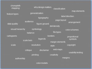
If you are a GIS professional who wants to learn more about map design, there are a number of areas that you can focus on in your quest to communicate through functional and elegant mapping. GIS Cartography: A Guide to Effective Map Design focuses on the major areas of color, typography, layout and creativity. It also provides an introduction to cartographic standards for 18 commonly used data-types such as roads, hydrography, elevation, and so on.
Within those major topic areas are a great number of sub-topics that can be explored individually. In this slide I attempted to record a few of those topics, though I am sure to be missing some. The intent of the slide was originally to simply joke about the sheer number of potential things that a nascent cartographer should learn, which is why it is laid out in a bit of a jumble. But it’s also a good visual for choosing what your next cartographic learning adventure will be.




Recent Comments